


9th - Cleland (Chambers Gully)
Some of SA's best... right next door to the city...

Cleland is 9th place on my top 10 of the Adelaide Hills running routes
Common starting location: There are many. There are multiple entries on Waterfall Gully road (chambers gully car park, winter track entrance, Waterfall Gully track), along with a few from Greenhill road (Chambers Gully Track), the Cleland Wildlife carpark and finally from the eastern side of the park (Sprigg road). My preference is Langman reserve car park, so I can run some less steep gradients for the first mile or so along waterfall gully road, before entering into the park via the Chambers Gully entrance.
https://maps.app.goo.gl/g9dUnzdyMznbWkFy7
Estimated Travel time from CBD: 10-15mins from the CBD – the closest location to the city on my top 10 list.
Toilet: Yes. Langman reserve.
Terrain type: A combination of many trail surfaces, recently reinforced compact dirt, variable rocky single tracks and some fire trails.
Severity: Moderate to hard, but mainly hard.
Strava Routes:
a) https://www.strava.com/activities/12610329846/overview
(Chambers Gully Loop ~ 18km and 550m elevation)
b) https://www.strava.com/activities/598691672
(Winter track + waterfall gully road extras – 16km and 600m + elevation)
Post run fuelling: As it’s close to the CBD, there are so many options. However, Spill the beans is close (and does a good brew).
https://www.facebook.com/spillthebeansadelaide/
Overview:
Historically Cleland would not normally make my top 10, but in recent times I have really enjoyed some runs through this region. Due to it’s proximity to the CBD and its popularity (mainly the Waterfall Gully track route) it’s hard not to include this park into a top 10.
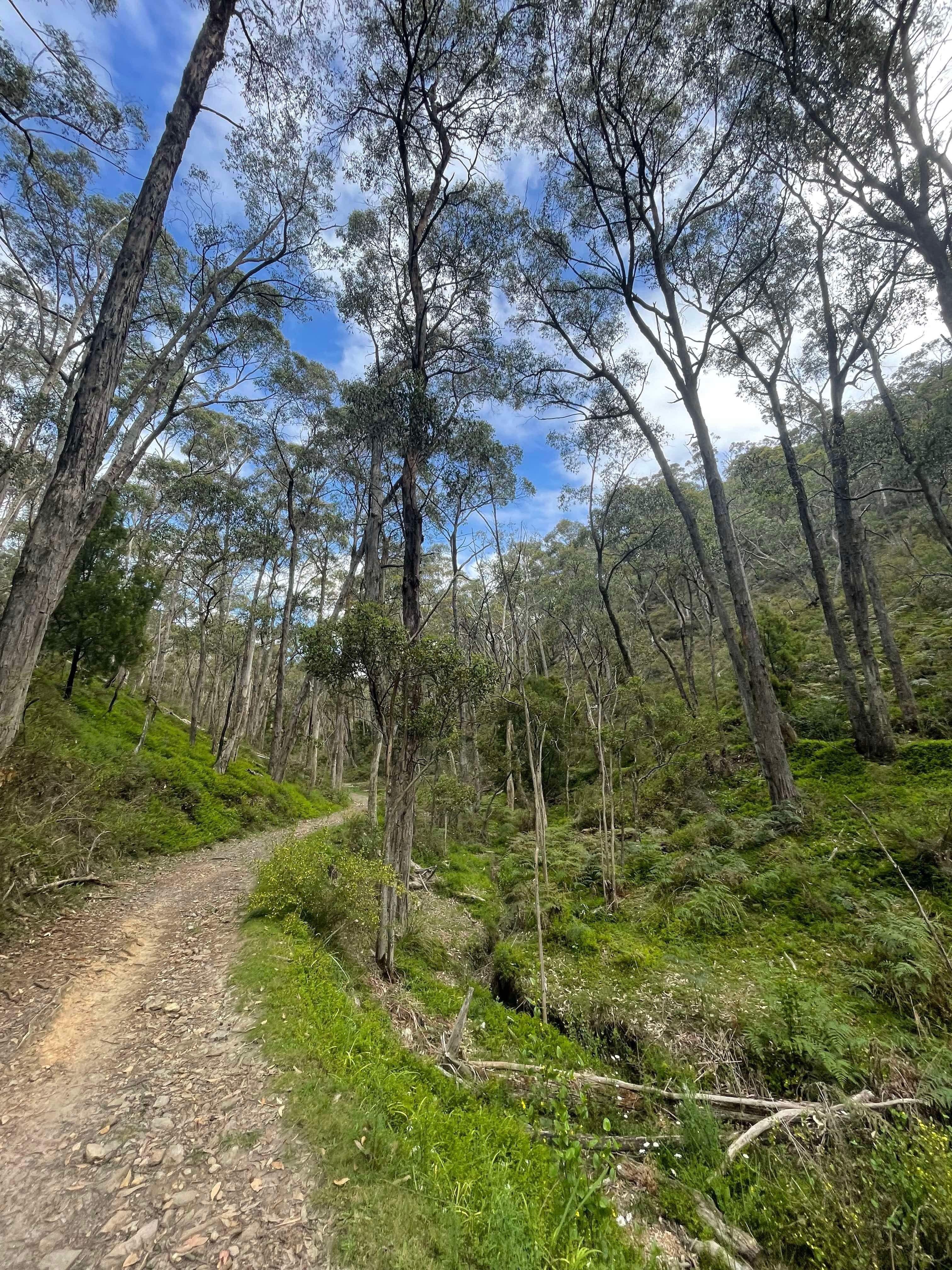
It is a true trail runners delight, with so many tracks that connect the bottom to the top and wind back and forth around each other. It’s very easy switch off in this region and explore the well signed tracks for hours on end.
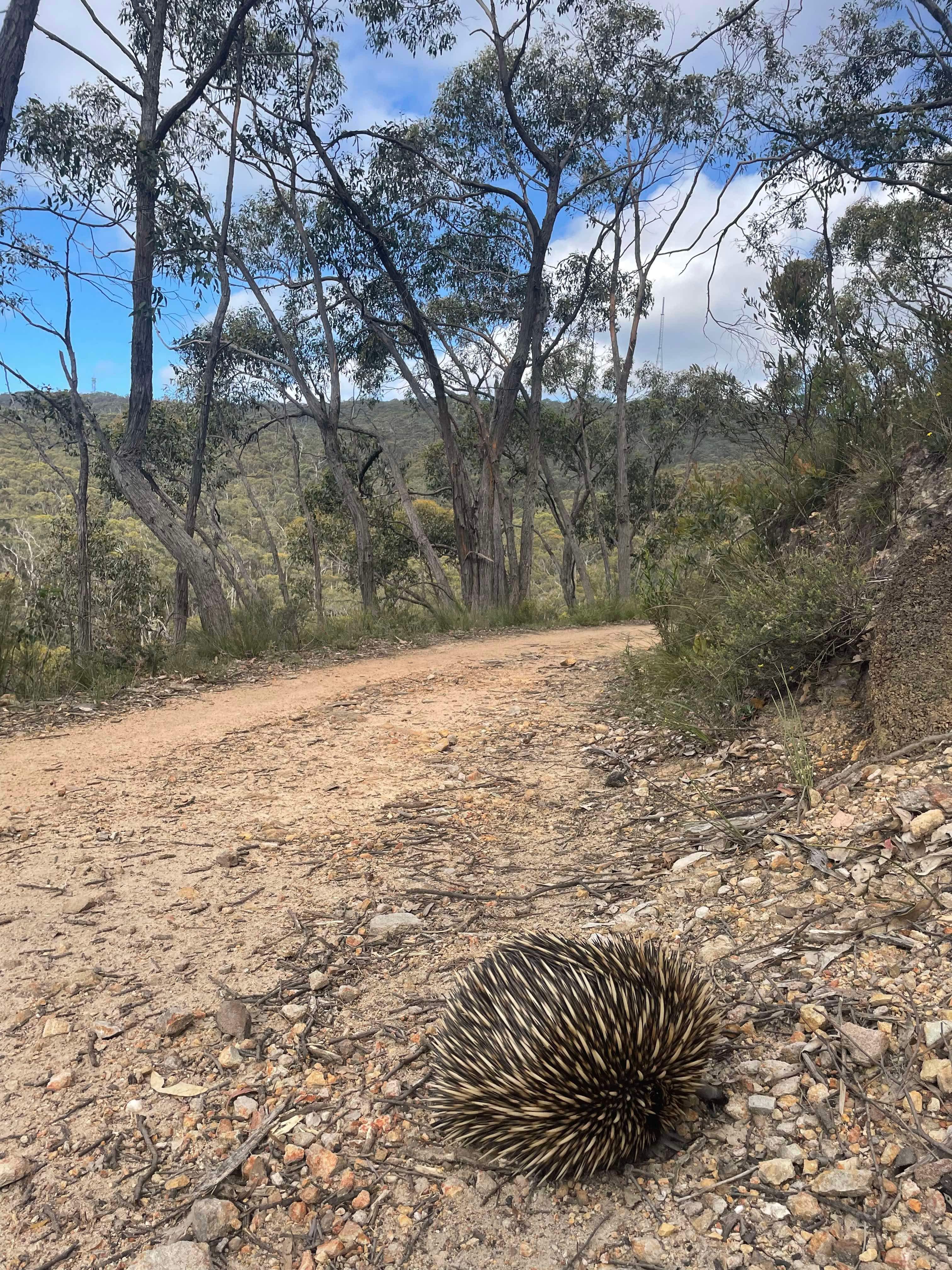
The park is full of SA flora and fauna, but with the gullies mildly invaded with lots of blackberry that thrive in the slightly cooler, wetter regions of the park. Most tracks that leave waterfall gully and go east up the hill are quite steep, with some tracks much more ‘runnable’ than others, and some tracks in which hiking can be as fast as running.
My preference to go up through Chambers Gully car park entrance mainly due to the fact it’s easier to keep running rhythm compared to Waterfall Gully track itself. The added bonus is now both the Bartrill Spur Track and Chambers Gully track have been resurfaced and you don’t need to pay as much attention to your footing (compared to historically), thus you can enjoy the surroundings as you travel up the hill. Chambers track is quite challenging track due to the severity of incline, and I can recall ASA hosting the Mountain running championships here many years ago (which I may have won in either 2016-17 of memory, obviously not sure many showed to the event). I certainly prefer taking the Bartrill Spur track through the thick gullies of native forest all the way up to the Long ridge fire track (Cleland Parkrun starting location)! This track is series of steep inclines and some false flats that help break up the monotony of a constant climbing effort, in which I truly enjoy.
There are some solid Strava Segments along this route as well, with Tom Middleton’s record one of the most impressive in this region (https://www.strava.com/segments/6802959?filter=overall ). From here, you can happily descent down the Long ridge trail, take a quick stop at the look, before taking the single track back down to the start. Alternatively you can continue to extend the loop, turning south by travelling down the winter track (that will take you toward waterfall gully road again). On the winter track, if you look just south, you will a popular steep climb, the Pengana Spurr track. This is one which I’ve seen but haven’t actually gone up yet, but you hear of keen trail runners completing repeats of this climb preparing for larger climbs located elsewhere. However, instead of travelling back down long ridge/winter track, I prefer heading further east by climbing up long ridge from Bartrill Spurr track, past the wild life park, and hit the beautiful wine shanty track at the most northeastern part of the park, and I’d argue one of the nicest tracks in the park (with my limited exposure).
There is not a lot of free flowing flat ground in Cleland, but you could argue after getting to the Wine shanty track from the bottom, it definitely feels like some more running rhythm can be achieved here (relatively speaking). Wine shanty is well shaded, has mixed terrain under foot that is fun during a wet winter, and has some nice little tracks that drift off east towards Mt Lofty Road (and eventually Mt Lofty). However, if you continue to follow the rolling Wine Shanty track, it will take north to Greenhill road, and if you love descending (which I hate), you will see a shiny new Chambers Track. It’s a steep descent, in which my poor skill set in the field tests my braking systems more than anything else. However, the new surface is so firm and smooth, I have seen road bikes travelling up this track, so it easy to descend without worrying about your footing. Once you are back on the Bartrill spur track, you can find some good relaxed pace heading back to the chambers gully car park. This is a nice loop overall!
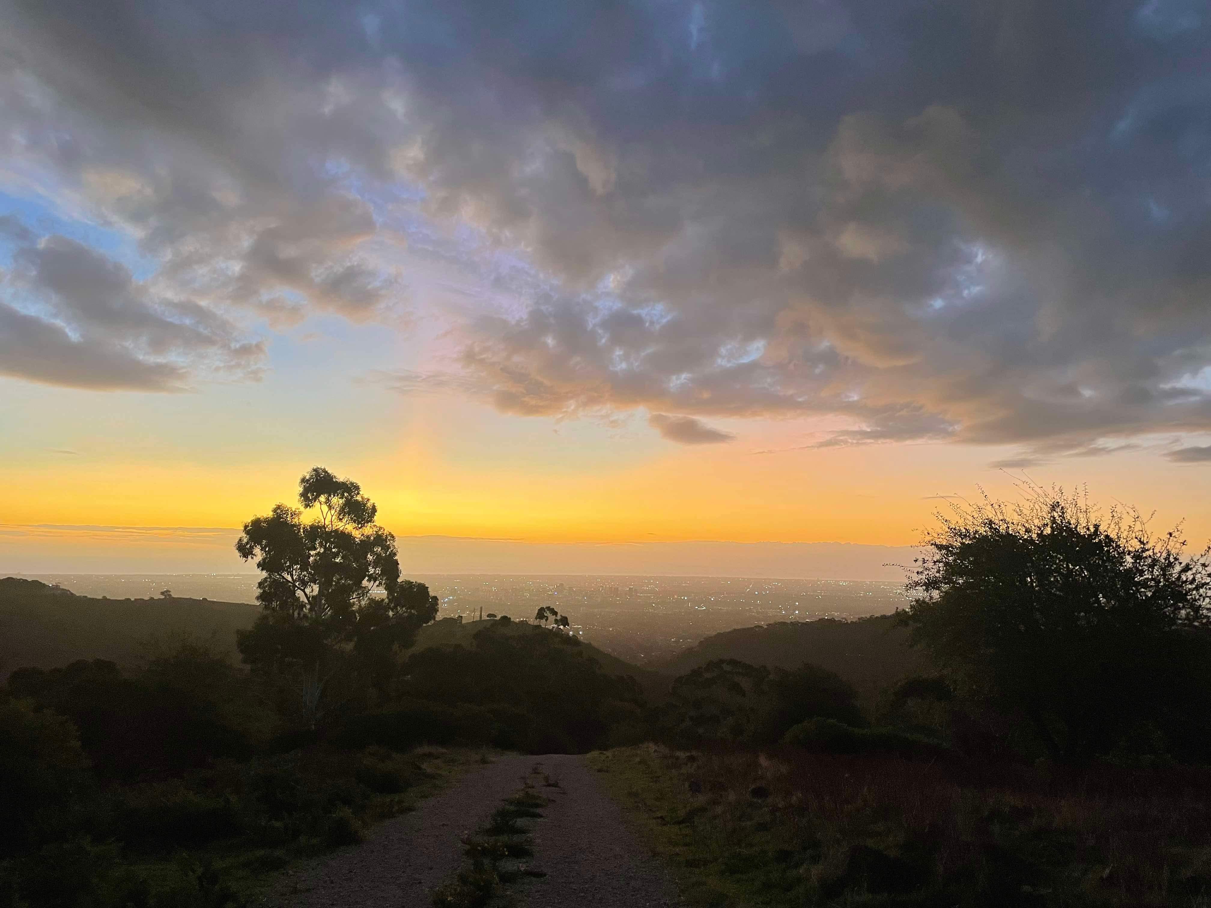
I am far from an expert of navigating these tracks, but my recent ventures into Cleland have enticed me to trial some new tracks (I am yet to spent a lot of time on the tracks east of Mt Lofty itself and further south (tracks that meet with the old Southern freeway). While there is a lot of climbing on this route, Cleland is a beautiful South Australian Park with so much variation of flora and reaches the highest elevation point in Adelaide (711m – Mt Lofty) which gives a famous view at the top. Cleland is most certainly more than just the Lofty track itself, and being only 15min drive from the city, it’s a great location to lose yourself on new routes.
Up next:
8th place: Mount Crawford (coming soon)